+1 more alert
EN
Find a bed
2027 Paid trails that must be booked: how it works

Your Madeira crossing
starts here.

The 6 stages from Poço do Gil to Ribeira da Janela with profiles, water points and tunnels, 77 campsites and places to stay, and itineraries from 3 to 8 days. Checked on 9 November 2026.

or explore the 6 stages

Madeira Crossing · main route
0 m500 m1,000 m1,500 m2,000 m0 km20 km40 km60 km80 km123456Pico do Areeiro 1,818 m
The Madeira Crossing elevation profile: 90 km, highest point Pico do Areeiro (1,818 m).
90 kmof trail
4,950 mof total ascent
6classic stages
77places to stay, checked
1,818 mhighest point

Everything to plan your Madeira Crossing — in one place.

Stages, campsites, itineraries, budget, bookings: every piece of information is checked, dated and sourced.

Around fifteen official trails linked together. And just as many bookings.

Paid trails since 2026, time slots to book, camping only in designated zones.

The Madeira Crossing is not something you improvise: plan it — and check it the day before.

Trail status

From Caniçal to Ribeira da Janela

The 6 stages — one by one.

Distances and ascent calculated on our route along the official PR trails and a 25 m terrain model.

Mountain campsites.

The IFCN camping zones, to be booked on SIMplifica: €5 per tent per night.

Campsite

1,230 m

Zona de acampamento do Chão das Feiteiras

Chão das Feiteiras, plateau north of Poiso (dirt track) · Madeira Crossing km 24.4

Grassy plateau surrounded by cedars, right by the route at the end of the climb from the Levada do Furado. It is the…
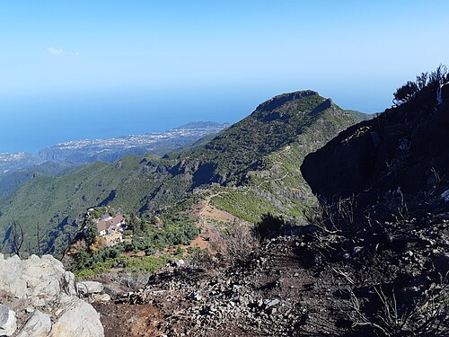
  • IFCN camping permit: €5 per tent…
Zona de acampamento do Pico Ruivo
Campsite

1,790 m

©

Zona de acampamento do Pico Ruivo

Pico Ruivo, near the Casa de Abrigo (access on foot only) · Madeira Crossing km 38

Camping zone on the ridge, at the junction of the PR1, PR1.1, PR1.2 and PR1.3 trails, a stone's throw from the hut and…

  • IFCN camping permit: €5 per tent…
Zona de acampamento do Chão dos Louros
Campsiteoff route

805 m

©

Zona de acampamento do Chão dos Louros

Parque Florestal do Chão dos Louros, on the ER228 below the Boca da Encumeada (north side) · Madeira Crossing km 47.8

Large forest park by the road, about 700 m as the crow flies from the Boca da Encumeada, on the São Vicente side. It…

  • IFCN camping permit: €5 per tent…
Campsite

1,255 m

Zona de acampamento do Caramujo

Caramujo, on the PR17 (Caminho do Pináculo e Folhadal), above the Levada do Norte · Madeira Crossing km 56.2

Small zone beside the PR17, about 8 km after Encumeada via the Levada do Norte and Folhadal. No water, WC or fire pit…

  • IFCN camping permit: €5 per tent…
Campsite

1,560 m

Zona de acampamento da Bica da Cana

Bica da Cana, edge of the Paul da Serra (tarmac road), near the forest house · Madeira Crossing km 58.5

Equipped zone (water, WC, fire pits, bins) about 200 m from the route, at the end of the open part of the PR17 coming…

  • IFCN camping permit: €5 per tent…
Campsite

1,510 m

Zona de acampamento Estanquinhos – Fontes Ruivas

Fontes Ruivas, Paul da Serra plateau (access on foot) · Madeira Crossing km 62.4

Camping zone on the route, about 1.5 km after Estanquinhos. It is the overnight stop chosen after the Encumeada → Bica…

  • IFCN camping permit: €5 per tent…
Zona de acampamento do Fanal
Campsite

1,135 m

©

Zona de acampamento do Fanal

Fanal, forest of centuries-old til trees (ER209 tarmac road) · Madeira Crossing km 79.5

Clearing in the Fanal forest of centuries-old til trees, on the route, just before the descent via the PR14. It is the…

  • IFCN camping permit: €5 per tent…
Campsite

20 m

Parque de Campismo do Porto Moniz

Ribeira da Janela, at the mouth of the valley near the old ER101, between the village and Porto Moniz · Madeira Crossing km 89.8

Madeira's only proper campsite, run by the municipality, at the bottom of the Ribeira da Janela valley, very close to…

  • Official rate not found; about…

Which itinerary is right for you?

Day-by-day plans with the distance, the ascent and where to sleep each night.

The questions we get asked.

How many kilometres is the Madeira Crossing?
Our route, reconstructed from the trails mapped in OpenStreetMap, is about 90 km long from Poço do Gil (Caniçal tunnel) to Ribeira da Janela, with about 4,900 m of ascent. The reference track of the Grande Rota is 88.5 km; the project presented in 2022 announced 93 km. See the stages.
Is Madeira's “GR1” an official trail?
Not yet. The Grande Rota is an official IFCN project, with works carried out in 2024–2025, but as of 9 November 2026 no legal act classifies any “GR”: the official list only includes short trails (PR). The crossing links official PR trails. The full story.
How many days does the Madeira Crossing take?
Allow 6 days sleeping in the IFCN camping zones, with stages of 10 to 25 km. Fast walkers do it in 4 or 5 days; you can also split it into two 3-day halves, either side of Pico Ruivo. See our itineraries.
Which direction should you walk the crossing?
East to west. The PR1, between Pico do Areeiro and Pico Ruivo, is one-way towards Pico Ruivo after the Miradouro da Pedra Rija: that is what sets the direction. So you start from Poço do Gil, near the Caniçal tunnel, and finish at Ribeira da Janela.
Is the crossing open at the moment?
Not entirely. As of 9 November 2026, two sections are closed: the PR10 Levada do Furado (stage 1) and the PR1.3 between Boca das Torrinhas and Encumeada (stage 3). There is no official detour. Check the trail status before you set off.
Do you have to pay to hike in Madeira?
Yes, since 1 January 2026, for non-residents over 12: €4.50 per PR trail, €10.50 for the full PR1, or €9 per day for two or more PR trails (excluding the PR1). Booking is by 30-minute time slot on the SIMplifica portal. How it works.

Ready for the Madeira Crossing?

Find where to sleep each night, from IFCN camping zones to the hotel on the pass.